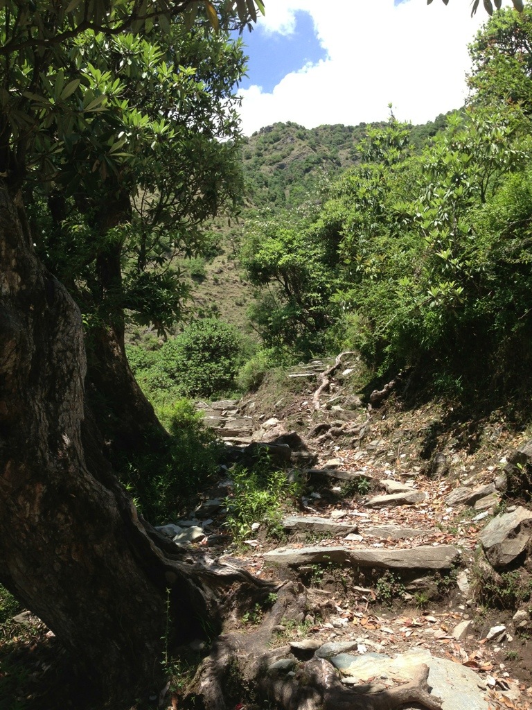
I took a hike beyond the suburbs and about 9km to Triund. At around 1200m higher than Macleod Ganj it is a good uphill walk over a rocky trail that winds around several hills and through rhododendron forests.


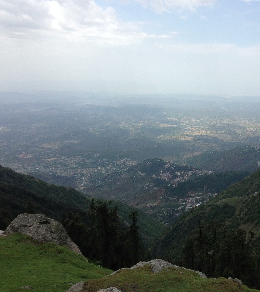
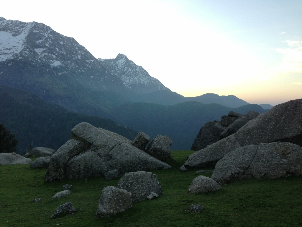
I met a young Cornishman called Ben drinking tea at a cafe on the way up. Together we reached Triund. It is a strip of land covered in grass and large boulders. It extends out towards the Southern plains below and provides awe inspiring views of Dharamsala to the West and part of the snow capped Dhauladhar mountain range to the North.

My intention was to trek the 60km to the Inderhara Pass. Ben would have liked to join me but was short of time. The next morning it began to rain quite heavily. I reconsidered my options. I was ill equipped: Insufficient warm clothing, no decent boots or trousers and missing my gortex coat lost with my stolen backpack. It is also a ‘rule’ of trekking that one should not trek alone.
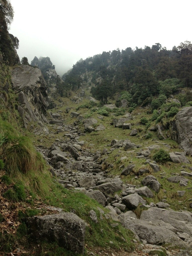
Finally the replacement ‘NorthFace’ backpack I was using was rapidly falling apart at the badly sewn seams. On its first outing in turned out to be piece of crap. I had to sew it back together along the way. I was feeling the cold and took shelter in the lodge provided by the Himachal Pradesh forestry commission. I wrapped myself up in blankets. Sitting on the step and watching the rain I decided I should return to McLeod Ganj. Once the rain had eased I stepped out but instead of taking the path down I was curiously compelled to wander uphill behind the building. I climbed a little higher and found the well marked trail leading North. Painted onto a rock were the words: ‘only one hour to snow line’. Encouraged by this I kept on going until I reached the ‘Snow line cafe’. The mountains looked stunning and towered above me. I continued on and stopped at a river before crossing a small thick glacier. It was an idyllic setting and became the high point of my visit to Dharmsala.
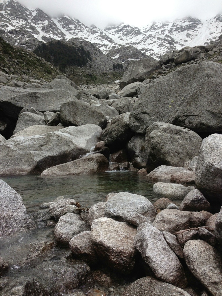


I climbed a little further to @3220metres and reached a small hillside forest decorated with Tibetan prayer flags. I sat for some time and watched a herdsman below leading his herd of goats across the river of thick ice.
I climbed back down and carefully picked my way across the frozen river. I planned to camp again at Triund but once there a chap tried to collar me for an extortionate ‘pitching’ fee. I was not keen to empty my wallet and had just passed so many beautiful places that I could have camped without the expense. I pressed on back down the trail. It was getting late and losing the light. It was a clear starry night. With inadequate space to pitch my tent I slept in my Gortex bivouac on the hillside and at yet another spot marked with a row of fluttering Tibetan prayer flags. The Dhauladher range poked out above the hills behind me and the Kangra valley plain spread out below me like a Google Earth map.
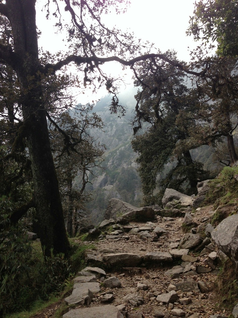
Following breakfast,which I shared with a friendly rook, I made my way back to the suburbs via a trail which led me eventually to the top road and small holdings at upper Dharamkot. From there it was a pleasant walk through the forest and back to McLeod Ganj.