Return to Asia

Standard
IMG_1959.jpg

Naribang – Mid Western Nepal

The big plan for my bike ride this year was to cycle from Thailand to the Spiti Valley in North India via Myanmar, the North Eastern Region of India and Nepal. It didn’t quite work out that way. But it wasn’t so far off course from what happened. I was pleasantly surprised how it all fell into place.

Cycling Myanmar (Burma) was a high priority. Having already sampled the country in 2015, and visited as far North and East (to Bhamo and Keng Tung) as permitted,  I was more than keen to return.  I had quickly grown to love the people and culture. It is a wonderful and exciting place which offers an experience closer to India than SE Asia.

The idea was to cycle from Bangkok to Kathmandu possibly via South Western Myanmar’s Chin State.  However the Western border crossing from Myanmar at Tamu to Moreh, Manipur, remained closed to foreigners. Civil unrest in Rakhine state compounded by government military action (and consequent United Nations interest in potential human rights abuses) closed much of Western Myanmar to foreign visitors. I watched developments carefully but, and despite a few travellers crossing into Myanmar from India, little changed. It appeared to be a dead end. I considered the possibility of flying out of Yangon to Calcutta or Dhaka in Bangladesh. However neither options appealed. It would be too much of a sacrifice to make and would, given the huge compromises involved, have become a pointless undertaking. By coincidence several friends were possibly meeting up in Cambodia close to Phnom Penh. I had never reached the Cambodian capital despite having explored Angkor and Siem Reap. The Southern Cardamon hills were definitely on my ‘to do’ list. But it wasn’t to be. The potential arrangements of flying to Phnom Penh and cycling back to Bangkok along the crowded Thai coastline didn’t appeal despite the allure of the relatively quiet Cambodian stretches of coastline. My eldest son gave me the lowdown on Phnom Penh. It didn’t sound great either. Watch your belongings people!  The meeting with friends was not happening either. Trying to dial in flights was becoming frustrating.  Both Myanmar and Cambodia were off the menu.

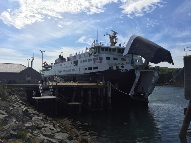
Plan ‘C’ was to fly to Luang Prabang in Laos via Bangkok. It was certainly unfinished business: I had intended to visit Luang Prabang via Vientiane when in Laos in 2015. Instead I had done the Thakheck ‘loop’ and cycled South to the Bolaven plateau before returning to Vietnam. This was finally my opportunity to visit the temple town of Luang Prabang.
From there I was to cycle back to Bangkok via the Mekong river, Vientiane and some of Thailand’s National Parks. Bangkok Airways also had a ‘bicycles fly free’ promotion. That certainly helped settle things. Here we go!

Increasingly my earlier plan to explore India’s North Eastern states fell away to nothing. I also had my eyes firmly set on the Kingdom of Bhutan. But, and despite making inquiries and provisional arrangements with a tour company in Thimphu (they even reserved flights), that just didn’t work in either. Bhutan has a huge appeal as one of the ‘happiest’ places in the world. But also, in a similar manner to Mustang, Nepal, costs the earth to visit. As an independent cyclist keen on doing my own thing on a shoestring budget I remain out in the cold as far as visiting Bhutan is concerned. I just could not justify the visit and a package tour is out of the question. Arunachal Pradesh to the East is an interesting and maybe more accessible place to visit. A protected area permit for Arunachal Pradesh (minimum two persons) is valid for 30 days from entry. An American friend in New York suggested we could meet up.  Together, it was suggested, we could cycle on some quite spectacular roads into the Himalayan mountains deep in Arunachal Pradesh. However, and when push came to shove, the timing wasn’t there. In fact I am not sure he had even left New York for his own trip some six months later..
My focus moved to Nepal as the next piece of the puzzle. Last year I completed the Annapurna trekking circuit. I cannot say just how blown away I was by that experience. On the back of that I researched the possibility of doing the Everest Base Camp trek. It is entirely possible to independently do a wide loop that includes the Cho La and Gokyo lakes. No permits are required. I downloaded all the relevant maps and did all the necessary groundwork.  However, and encouraged by glowing reports, I settled on the Tsum Valley and Manaslu Circuit trek. Although this usually requires a minimum of two persons and guide I was able to find a tour company based in Kathmandu that would make the arrangements for me and provide a guide. Although expensive in comparison to my normal ‘cheapskate’ travelling costs it was to be an awful lot less than if I had used one of the popular UK based trekking companies.
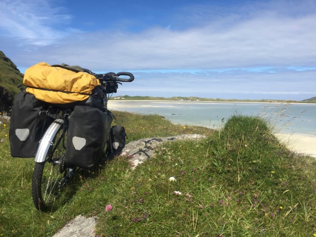
My itinerary was taking shape; a month in Laos and Thailand followed by three weeks trekking in central Nepal before getting back on the bike. I knew that I wanted to end my trip back in Ladakh and ‘do’ the fabled Spiti Valley.  Having already crossed Nepal via the East -West highway (Mahendranagar, Bhutwal, Tansen, Pokhara, Kathmandu) during 2013 I thought this time to travel West in the opposite direction via Nepal’s ‘Mid-Hills’ from Pokhara to Baglung and Dadeldhura.  I created a route which would follow, in many respects, the anticipated path of the proposed Mid-Hills Highway. It was to prove a difficult task to complete as much of the ‘highway’ that currently exists is in the very early stages of construction. However the route was there in some form or another.
The next section, once in India, was to skirt West across the Himalayan foothills via Rishikesh and Dehradun in Uttarakhand. This would ultimately bring me to Rekong Peo and the ‘inner line’ area that  borders China. This, in turn, leads to the Spiti Valley  and Lahaul in Himachal Pradash. I would then be back in familiar territory having cycled the Leh-Manali highway in 2013.
Leh was to be my final destination this year. Once there I hoped to attend a monastery festival, trek to over 6000m (Stok Kangra) and explore much more of Ladakh. All this was dependant on the time available before finally flying home via Delhi. I really wasn’t confident of achieving all this and, as on previous big trips, half expected it all to change once there.

It seemed like a tall order. Somewhat complex too with multiple flights and timing.
I was to get my visa for Nepal on arrival at Tribhuvan airport and a six month visa for India from their embassy in Kathmandu.

What could go wrong?

Last year I may easily, without timely intervention, have frozen to death in a blizzard that hit me crossing the high altitude plateau of the GBAO in Eastern Tajikistan. Earlier in the trip I had been detained, interrogated and threatened with deportation having accidentally stumbled into a Tajik military camp in Khorog close to the Afghan border. But, and despite such excitement, it all worked out just fine.

During this years trip I did suffer from a persistent gastro intestinal infection. This, combined with poor nutrition and high workload, reduced me to a low body weight.
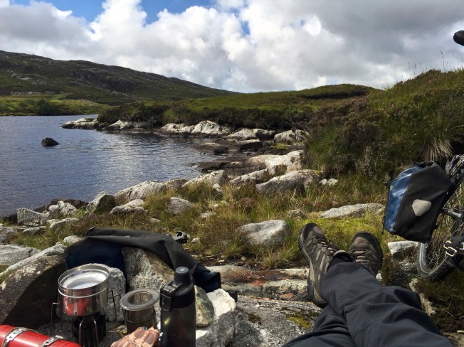
I also suffered from a knee injury that dogged me during my trek.  But maybe the most significant event was when my fully loaded bike fell into a river ravine.  I watched it disappear  from view and swore out loud. I considered, at that particular moment, all to be lost.  However and in a slightly precarious manner I was able to retrieve nearly everything and continue into Ladakh.  The Zanskar valley was incredible.
It was certainly the toughest and most spectacular trip that I have undertaken so far.
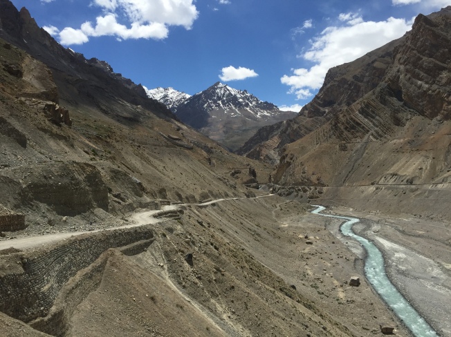
IMG_5230.JPG

Spiti Valley

Home again.

Standard


Another bike ride done.

Laos, Thailand, Nepal and Northern India. The Spiti Valley pictured above.
A return and extension to previous journeys. In many respects it was the ‘ultimate ride’ which pushed the envelope a little.. I suffered a bit!

More to follow..

Hebridean Island Hopping

Standard

IMG_3512

I felt somewhat embarrassed to have never visited Scotland. I have never been to Ireland either for that matter. It was something that really needed correcting. A Visit Scotland flyer dropped into my newsfeed recently and featured a photograph of cyclists hitting the trails across some inspiring island landscapes. I became seduced by the idea of cycling across the Outer Hebrides.

   ‘Crowned the Hebridean Trail, this 280km bike journey weaves its way through seven superb islands on a variety of ancient paths, historic by-ways, mountain tracks and impossibly quiet roads.’

Sustrans Route 780 runs the length of the Outer Hebrides from the island of Vatersay in the South to the Northern tip of the Island of Lewis.It seemed like just the tonic to help me overcome my post trip blues following my return from riding the Pamir Highway.

However, and possibly more to the point, my daughter Rosie loved the idea of visiting Scotland too. I busied myself and prepped a Dawes Watoga mountain bike for her. I attached a rear rack, upgraded the brakes, fixed a shorter stem and a more comfortable seat. It looked great with my old orange Karrimor rear panniers.  My Surly Long Haul Trucker got a new middle chain ring; replacement bottom bracket;  new Kool Stop pads (finally); Thorn stem and replacement XR tyres. The weather forecast for the Hebrides was a bit crap. However it appeared to be more promising for the following week. It was also an opportunity to test out the bikes and make further modifications.

Looking good.  All set to go!   But no….   A few days before we were due to leave Rosie got cold feet and cried off.  C’est la vie.  Undeterred  I headed off up the A1 with the Surly LHT, usual touring and camping gear in the back of the car. Och aye. I was finally going to ‘bonnie’ Scotland. Probably the most interesting thing I saw on the journey up was a burnt out car in the car park of a service station on the M6.

The scenery changed quite drastically once past Glasgow and the River Clyde. Loch Lomond looked incredible! The A85 took me to the bustling harbour town of Oban in Argyll. It was easy to park a few streets up the hill from the harbour and slept in the car overnight.

IMG_4377

From there I took the ferry to Barra courtesy of Caledonian Macbrane ferries. A flexible ‘Hopscotch’ ticket is valid for a month and provides for multiple journeys across the islands for £28. I wasn’t too sure how I would return to Oban. I considered the ferry from Stornaway in Lewis to Ullapool and then cycling back via Inverness on the East coast of mainland Scotland. But it didn’t seem ideal. An alternative option appeared to be cycling back through Skye.  I popped into Oban Cycles to ask their advice. They hire out bikes (£125 week) and for an extra £25 will retrieve a hire bike from Ullapool. I mentioned the route via Skye and that option was, if anything, the best way to cycle back. It was, in their words, the ‘ultimate’ circular ride taking in the Outer Hebrides. They also mentioned and highly recommended to stay at a hostel on Berneray. This turned out to be excellent advice!

The ferry from Oban to Castlebay on Barra takes less than 5 hours. Bikes (carried free) are tied up on the car deck. The journey is relatively smooth and facilities are good. All of the ferry services were well done. On each island Caledonian Macbrane provide heated waiting rooms with WCs and free wifi. Some even have power sockets.IMG_3882

I like the island of Barra a lot. Beautiful bays, sandy beaches and relaxed lanes around picturesque hills make Barra a wonderful place to visit. When the sun shines and the jet stream drops South the Outer Hebrides enjoys the kind of hot dry weather that could, potentially, turn the islands into a popular holiday destination.

IMG_3149

IMG_3141

I cycled to the Southern island of Vatersay and to the beginning of the Sustains route 780.

With the evening drawing in I returned to Castlebay and rounded the island to the West before pitching my tent overlooking a sandy beach between Borve and Allasdale.

IMG_3155

The next day and before taking the Ferry to the next island of Eriskay, I dropped into the cafe at Barra Airport for tea. With regular scheduled flights to Glasgow it is unique in so far as it is the only airport in the world to use a beach for its runways.IMG_3188

IMG_3200

IMG_3205

IMG_3212

From Eriskay it is possible to cross over onto South Uist via a long causeway. The group of islands of South Uist, Benbecula  and North Uist extend over about 100km of less remarkable scenery and are each connected to each other via causeways. Wild camping is easy enough, as with all the islands but there is a youth hostel at Howmore on South Uist.

IMG_3221

IMG_3223

IMG_3259

IMG_3290

IMG_3413

IMG_3448

IMG_3497

For my third night’s camping I cycled inland off the recommended cycle route and up to one of the highest spots on North Uist off the single track Committee Road which cuts across the island. From there it was a  relaxed ride over another causeway onto the island of Berneray. A little way beyond the ferry terminal and main village is the hostel recommended by Oban bike shop. It really is a great place and well frequented by visiting cyclists. I met one chap there (with his Thorn Nomad) who had been a designer in Birmingham for Dawes cycles during the late eighties. The standards of accommodation at the Berneray hostel are very high having been recently refurbished. There is no booking or reservation.  The facilities provided on the islands by the Gatliff Hebridean Hostels Trust provide an excellent option for visitors; ‘Cyclists and walkers will never be turned away’.

IMG_3501

IMG_3519

IMG_3510


£14 bags a bed in one of the dorms and full use of the well equipped facilities including hot showers. Aside from basic food supplies everything is provided.  A local resident dropped by selling fresh dressed crab and couldn’t resist buying one to use for lunch the next day. With lots of happy cyclists filling the place the long table in the kitchen diner was covered with emptied bottles by the end of the evening. I retired early with a view to catching the 07.15 am ferry to South Harris.

Maybe I left a little late after breakfast and pedalled quickly over the few hills towards the ferry. It was cutting it fine and I waved now and then hoping that the ship’s captain on the bridge would see me cycling towards them. Finally, and just in time, I made it onto the ship. The bow doors closed in my wake. It was another clear lovely day and I was excited to be sailing towards Harris.

IMG_3544

IMG_3578

IMG_3601

IMG_3602

IMG_3621

IMG_3645

Route 780  follows the Western coast of South Harris before climbing towards the centre of the island and dropping down towards the town of Tarbert. An alternative, and one that I would have loved to see, is the ‘Golden Road’ which tracks across and around the Eastern coastline. The name ‘Golden Road’ reflects the huge costs of creating a road across a long stretch of coastline and terrain consisting mostly of rock and water. I regret missing that one. However the Western road is quite spectacular. Beautiful beaches, high rocky roads, freshwater pools and awe inspiring views provided an unforgettable journey.

IMG_3660

From the town and port of Tarbert the road runs along the West coast towards the castle at Amhuinnsuidhe. The cycle route however pushes up past the Clisham mountain which, at 799m, is the highest point in the outer Hebrides. The road is a challenge but once climbed  affords wonderful views towards Loch Shiphoirt.

IMG_3687

IMG_3693

IMG_3715

IMG_3799

I stayed several nights at the GHHT hostel at Rhenigidale on Harris. It was a crofters cottage with a good kitchen and woodburning stove in the living room. Three upstairs rooms provided bunkbeds for up to 12 visitors. It was a fairly quiet out-of-the-way kind of place and for my second night had the cottage to myself.

A ‘rest day’ from cycling was spent tackling the ‘Postman’s Path’ from Tarbert to Rhenigidale. It has a reputation as ‘the most beautiful path in Britain’. It is wonderful and stretches up over boulder strewn hills past brooks and streams. It meanders past waterfalls and up and down past beautiful little sea coves. I stopped on one small beach and watched a seal in the water nearby. Some sections are popular with cyclists on mountain bikes. However it does become very difficult with very steep inclines and the path narrows to just a few inches around rocks and deep vegetation. To cycle that you would have to be a little mad. I had considered the possibility of getting my fully loaded touring bike back along the path to reach the ferry at  Tarbert. However I quickly realised that it was nigh on impossible. It would have required physically carrying everything up and over long severely steep inclines with little easy footing. Walking the ‘path’ was difficult enough. I decided I would return to Tarbert using the road over the centre of Harris.

IMG_3741

IMG_3749

IMG_3767

IMG_3762

The postman, I was to find out later that evening, was Kenneth Mackay  who had followed in the footsteps of his uncle. The village had no connecting road until the 90’s and Kenny delivered the post three times a week via the coastal and hill walk from Tarbert. By coincidence Kenny looked in on the hostel. He was keeping an eye on the place whilst the caretaker was away. We sat and had a chat and it wasn’t until the conversation turned to my earlier walk did I then find out that he had been the postman.  To have walked that route in all weathers all year round must have been quite a herculean task. My legs ached for days after doing that walk.

IMG_3807

IMG_3859

IMG_3819

Admittedly I did not complete Sustrans Route 780 and the ‘Hebridean Trail’. Lewis looked less interesting from a geographical point of view and preferred to spend longer on Harris before sailing to Skye. A friend later said that it wasn’t such a bad idea. He hadn’t enjoyed cycling to Stornaway that much. I do not feel that I have missed much. However Skye was yet another adventure. From Uig the road follows South past the pretty picture postcard port of Portree. Heading further South and cross country I was bowled over by the magnificent sight of the Cuillin mountain range. At Sligachan next to Loch Ainort there is a campsite and hotel which is perfectly positioned against the dramatic backdrop. It is a hub for climbers and sightseers exploring the surrounding munroes.

IMG_3911

IMG_3912

I stopped for a pint of the locally brewed Blackface bitter at the Sligachan Hotel Seumas’s  bar and marvelled at their huge collection of whiskies. Initially I sat in their garden but the swarms of attacking highland midges made that impossible.

IMG_3924

The weather had turned a bit horrible and made camp for the night under a road bridge to the west of Glaimaig hill. I had been lucky up to that point with mixed weather which had provided plenty of sunshine. Now it was constant rain and heavily overcast. The weather improved the next day and was impressed with the dedicated cycle route that cut across the centre of Skye towards Isleornsay on its Southern coast. However it began to rain heavily and I took refuge for a while in a bus shelter. But, and once again, it brightened up.

IMG_3978

IMG_4021


Once at Armadale I was able to catch a ferry to Mallaig. I grabbed some supplies in the Co-op supermarket close to the harbour. Almost opposite the store is Mallaig railway station. It occurred to me that it was a good idea to hop on a train to Fort William if possible… There was a fine looking train in the station but could find no ticket office. Pushing my bike along the platform I was directed to the conductors office on one of the carriages. He was pleased to sell me a ticket and we lifted the bike from the tracks up into the first carriage behind the locomotive.
I had, inadvertently, found myself on board a train pulled by the famous ‘Jacobite’ steam locomotive. The West Coast railway service between Mailliag to Fort William has been described as ‘the greatest railway in the World’ . I was to ride directly behind the Jacobite as it puffs and whistles and winds its way to Fort William.  How cool is that!  IMG_4039

IMG_4034

IMG_4042

It is a popular journey for fans of the Harry Potter movies having been featured in the first movie as the steam train taking Harry to Hogwarts. The journey is certainly very magical and I loved every minute. As the train passed through tunnels the steam poured into the carriage through the windows. I had a seat but spent much of the journey with my bike directly behind the locomotive and with excellent views on either side from open windows. It was the unexpected highlight of my cycling trip!


IMG_4044

IMG_4076

IMG_4093

IMG_4139

Arriving fairly late in Fort William meant that finding a camping spot was a priority. Lachlan, the train conductor, had suggested a spot around the base of Ben Nevis. But I took the road Westwards on the edge of Loch Linnhe towards Oban and the national cycle route 78. I quickly found a suitable lay-by and nearby woods on the banks of the loch to pitch my tent.

IMG_4149

The following morning I found the national cycle route 78. It is an absolute joy to ride. Dedicated sealed paths follow along what once was the old railway line. It cuts through rocks; alongside lochs; through green fields and over hills often with inspiring views. Occasionally it joins the main road but soon returns to its own dedicated trail. All credit to Sustrans and all those that helped create this brilliant cycle route.
Once back in Oban I treated myself to a curry and a pint of heavy in a local pub and overnighted in the car. As an extra treat I drove home via Edinburgh and walked around the trendy new town for a bit before saying my farewell to Scotland.
Highly recommended… I loved Harris in particular. Although, and to be perfectly honest, good weather makes all the difference.


IMG_4237

IMG_4221

IMG_4300

IMG_4320

IMG_4315

IMG_4371

Riding the Pamirs

Standard
IMG_1471

Yashilkul

Before providing the usual blog entries and photographs of my trip to the ‘roof of the world’ I thought to create a short brief on cycling the Pamirs. I prefer to blog as I go but with rubbish connectivity in Tajikistan I simply batch posted a load of photos on FaceBook and left things till I got back home. I admit that I am still a bit blown away by trekking in Nepal the month before and found the visit to Tajikistan an anticlimax in comparison. But it had its moments and have, once again, a huge repository of photographs from the ride. It should, hopefully, give others a fair impression of what lies ahead should they choose to do a similar route.

The M-41 or ‘Pamir Highway’ in central Asia enjoys a reputation as being one of the ‘top three’ world rides for adventure cyclists. During the Summer months from June through to September, cyclists from all over the world descend in droves to experience the famous ‘Highway’ across the ‘Roof of the World’.

The typical ride begins in Dushanbe; the capital of Tajikistan and winds up into the mountains to the East before dropping South down to the town of Khorog. The M-41 then continues East across the Gorno-Badakhshan Autonomous Region of Eastern Tajikistan over several hundred kilometres of high altitude desert, before finally dropping towards the somewhat desolate town of Murghab. From there the road continues to the Northern border with Kyrgyzstan via Ak Baitel (4,655m). It is then a further 226km to the City of Osh in Northern Kyrgyzstan. The total distance is around 1,250 km. Large sections of the route are over 4000m above sea level.  Weather, altitude and remote conditions combine to make it a potentially difficult route. Timing is crucial. Without adequate acclimatisation altitude sickness can become a serious problem.

It is cited as the world’s second highest altitude international highway and, naturally, a compelling challenge to touring cyclists looking to experience the ultimate ride.

 The ‘Pamir Highway’ strictly speaking refers to the section of the M-41 highway between Khorog, located in Gorno Badakhashan, and Osh in Kyrgyzstan. Built between 1931 and 1934 by Soviet road engineers, it supported the supply line between Gorno Badakhshan and the Soviet Union. The road followed the route taken by local herders and the caravans of traders travelling along a section of the ancient ‘Silk Road‘.  Once completed it connected with the road between Dushanbe and Khorog that had been already been built by Tsarist decree in 1912.

I had marked the highway as ‘one to do’ some years ago having enjoyed the Leh-Manali road and hoped to replicate the joys of that experience. However the trip had been shelved partially in lieu of a new bike build. The Pamir Highway suits a more expedition approach to cycling rather than the all singing all dancing classic touring arrangement that I have with my Surly Long Haul Trucker and panniers. I looked in particular at a more lightweight ‘bike packing’ setup. But when a friend invited me to join his group ride I couldn’t resist..  After all what could go wrong?  I had not done a great deal of research on the ‘Highway’ and happy to follow the lead. But, and as it happened, there were problems. Timing and the weather was particularly bad. Flooding and landslides created delays. Following an initial abortive attempt to cycle East on the M-41, I was forced to return to Dushanbe and plan my trip from scratch. However it all worked out very well and was glad to have had the opportunity.

IMG_1871

Koj-Tezek Pass (4271m)


The definitive website for all things Central Asia including visa advice and up to date travel news is provided by the comprehensive website; Caravanistan. For cyclists the Crazy Guy On a Bike website (as always) provides an exhaustive source of information on tackling the Pamir Highway. It hosts a huge number of travel reports  and blogs by cyclists that have made the trip across the Pamirs and into the ‘stans. For those visitors that have time constraints.. and maybe less inclined to cycle certain sections, shared taxis (4WD) or ‘jeeps’ can be hired fairly easily at local bus stations or by arrangement through hotels etc.

IMG_0832

Some cyclists take the ‘Southern route’ out of Dushanbe along the  A385 with a view to joining the M-41  East at Qal’a-i-Khum. The road is mostly sealed and the main route used by traffic including heavy goods vehicles.  However the road beyond Kulob towards Qal’a-i-Khum becomes quite tortuous as it clings to the mountain side and follows the Panj river alongside the Afghanistan border. Rockfalls and landslides are not uncommon and invariably cause delays.IMG_1045IMG_1078

The shorter and more direct 520km route from Dushanbe to Khorog over  the Khaburabot Pass (3,252m) provides wonderful views and personally found it to be the most attractive part of the M-41 . However, and like the ‘Southern’ route, it is subject to regular landslides and flooding. Cyclists pushed for time choosing this route could realistically start their ride 140km East from Dushanbe where the M-41 crosses the Kyzylsu river. That would also avoid nasty suffocating traffic and, what is currently, a poorly surfaced (deep gravel) section of road. It is also the point where the ‘Highway’ begins to wind up through the mountains along a simple track with no traffic.. and where it all becomes one big glorious adventure.

IMG_2522

Khaburabot Pass (3252m)

IMG_2549IMG_2537

One excellent option for touring cyclists is to continue on the road South from Khorog along the Panj river and down to the Wakhan Valley.   The Wakhan ‘Corridor’ (350km long and up to 65km wide) is a rather odd extension of Afghanistan territory running East to West and forms a political ‘buffer zone’ between Tajikistan and Pakistan. The valley offers superb unspoilt views, crumbling forts and beautiful villages all set against the magnificent backdrop of the Hindu Kush massif.

IMG_1266 IMG_1293

IMG_1298

Wakhan Valley in Afghanistan

A few essential aspects of travelling in Tajikistan are worth underlining:

It is insanely CHEAP.

It is extremely SAFE.

You will find GOOD FOOD and plenty of it in towns and villages.

You will find GOOD PEOPLE. They will go out of their way to help you and are honest.

You will fall in love with the place and its people.


IMG_1258.jpg

The Wakhan River


Tajikistan

Image

img_0714
I had planned to embark on a cycling tour of South America during 2016. It certainly ticked all the boxes with phenomenal looking high altitude landscapes and awe inspiring locations. But the timing didn’t seem right.  Aside from certain ongoing commitments at home I had a ‘bad feeling’ about the venture. Maybe it was the reports of cyclists being robbed at gunpoint. So my intended flight window in late February came and went. It is just as well since a massive earthquake hit Ecuador.

But and being the lucky guy, I had the opportunity to revisit Nepal. The ‘lost kingdom’ of Mustang already had my attention. A few years previously when standing with a grandstand view of the Annapurna range from the Sarangot viewpoint above Pokhara I had looked and wondered if.. maybe..

A month in Nepal took me from Kathmandu to Pokhara via the Annapurna ‘circuit’, over one of the highest trekking passes in the world and then into the high altitude desert of Mustang. I loved it.  To say it was an awesome experience is an understatement.

However, and just prior to that journey, I had been contacted by another ‘cycle tourist'(Andrew) with regards joining his group trip to Tajikistan.  He had several potential companions but they had dropped out. I asked him to keep me ‘in the loop’.  I am not great with other cyclists but would think about it. The M41 or ‘Pamir Highway’ is one of the great adventure cycling routes and had earmarked that one as a ‘possible’. When push came to shove I thought why the hell not. It seemed cheap enough. Flights were booked. Andrew opted to fly into Istanbul with British Airways from Newcastle. Turkish Airlines would take me from London all the way to Dushanbe via Istanbul. Better in my mind to let them take care of the bike and luggage for the whole distance than mess around at transfers. Prices weren’t too bad either. Turkish airlines have different regional rates for flying bikes. It works out to less than £75 each way for the bike.

Bike prep went okay. It already benefitted from a fair few replacement parts. It was good to go. My only reservation was that my bike and gear were too heavy. I can no longer, maybe because of my increasing decrepitude, shift it like I used to. It had been my plan to convert to a lightweight  bike packing setup as part of an  all new ‘expedition’ bike build.. possibly including a Rohloff and SP Dynamo hub. But with so much newly fitted on the Surly it needs to be ridden. With my bike and gear tipping the scales at over 35kg I panicked a little, unpacked and tried to cut everything back to the bare minimum. Spare tyre and third tube were put to one side. This proved to be a bit of a mistake..img_0511


Tajikistan provides a 30 day visa on arrival at Dushanbe airport. Formalities require the completion of an immigration  questionnaire together with a visa application. Both forms are available at the visa office opposite passport control. The visa requires a passport photo and costs $45. Somehow Andrew had neither money (packed in luggage) nor a photo. But we managed and they used a copy of his passport for the photo. A guy in the queue told us it was important that visitors needed to get their hotel to stamp the immigration form before departing.

It was 5am, dark and chucking it down outside the airport. But Andrew was keen to get out and quickly we found a ($10) taxi that would take us the 2km to our booked room. I thought we might have to politely hang in the street till people awoke but the taxi driver quickly rang the bell to the hostel and one of the owner’s sons opened the gate. We were home and dry bikes n all.

img_0618
Green House Hostel (Tel +992 880082725) is perfectly positioned close to the airport, railway station, GBAO permit office and the Green market. Having only opened its doors to travellers in 2014 it provides what can only be described as the best experience one could expect. It is family run. Prices are better than good and provides self catering and high quality lodging. It is both comfortable, luxurious and with a very relaxed atmosphere. It is a gem of a place to stay and hugely popular with touring cyclists.

Andrew hit the sack having pulled an all nighter. I hit the road into town to test my rebuilt bike.

img_0550

Dushanbe is a very green, very clean city which quickly reveals its Soviet colonial past. Grand buildings and statues nestle amongst open green spaces filled with flowers, grass and trees.  It was a holiday; ‘Victory Day’. Having stopped by the statue of Ismoil Somoni,  an uniformed official made a bee line for me and demanded ‘money..money.. dollar’. I smiled and carried on towards a few more local sights. This included the second highest flagpole in the world and which, somewhat oddly, is rated as one of the recommended attractions in the guide books. It is a flag pole and it is tall.img_0563

img_0545

img_0543

The process of obtaining a permit to visit the Gorno-Badakhshan autonomous region of Tajikistan is fairly straightforward. See here. It does however take a day or so unless there are special arrangements. By luck more than anything else we revisited the issuing office later the same day and it was ready for collection. Now there was little to stop our adventure East along the Pamir highway and set off the next morning in the sunshine…

The Western Ghats

Standard

It was crunch time in Ooty. I needed to make a decision.  My options were to either continue South towards the Cardamom hills or head North and drop down towards the coast via the Western Ghats. I decided to take the R67 North which would bring me back into the subtropical forests of the Nilgiris Biosphere Reserve.

img_4054

A quick shot of the magnificent machine at the top and I was off. I had looked hard and long at the map and knew that it was going to be pretty much downhill all the way.  I was surprised to see so many horses roaming freely on the roads. It appears that they are used in season for racing and for giving rides for tourists. However their owners don’t feed them but leave them to fend for themselves on the local roads.

img_4057
IMG_4064

Once past the Sandynalla reservoir it was a relaxed ride past extensive tea plantations and deep conifer forests. The mists were so thick I could hardly see the road ahead and stopped to attach lights. Being next to a tea plantation I couldn’t resist stepping inside for a closer look. A guide jumped out with a book of tickets and was keen to show me around for a fee.  I turned back; ‘No no.. thanks for the invitation but just passing..no time.. bye!’ Back on the bike..

img_4080

As I dropped down the temperate forests gave way to an altogether different world. I was treated to superb views and lush subtropical surroundings. It certainly felt good to be warm again.  Ooty had been so damp and grey.

IMG_4104.jpg

At Gudular I took the R12 west to the junction at Nadugani where I sat, drank tea, and met the local madman. He was harmless enough. I continued on the R28 towards the Amarambalam Reserve Forest and the border with Kerala. Yay! I was as pleased as punch to reach Kerala. It may have taken a while but I did get there in the end.

IMG_4146IMG_4163.jpgimg_4185

Given that the day was wearing thin I liked the idea of stopping early to set up camp in the jungle. It was an exciting prospect in itself but was also worried that, once out of the Amarambalam wildlife sanctuary and back into ‘civilisation’, I would not find anywhere discrete to camp. However the steep slopes either side of the road meant that there were few good spots to be had. I thought I had finally found a suitable spot on a ridge. But then noted animal tracks.. possibly elephants and, of course, the ground was covered with huge ants.  I didn’t fancy being trampled or overrun in the night. I had to move on. The monkeys weren’t helping either.

IMG_4171.jpg

Finally, and having dropped down beyond the boundaries of the park, I did find a place to camp. Not quite the panoramic view that I had hoped for.. but not bad. The tent is aways good.

img_4198img_4201
I was  now close to the village of Muttikadavu and the Punnapuhza river approximately 100km from Ooty. It had been a great, mostly down hill, day.
Only another 75kms and I would be able to dip my toes in the Arabian Sea. But first I had my heart set on visiting the Krishna temple at Guruvayur.


Udhagamandalam (Ooty)

Standard

IMG_3920

So.. and having escaped the attention of savage wild tigers or being trampled underfoot by charging elephants I left Mudumalai Park and climbed up through the clouds to find myself at the settlement of ‘OttaikalMandu‘ (Ooty).  But it looked a bit crap…

The Nilgiri hills form a low crescent stretching across the three states of Tamil Nadu, Karnataka and Kerala. The popular tourist town of Udhagamandalam or ‘Ooty’, at an altitude of 2,240m, is just under 500m lower than Doddabetta; ‘the highest peak of South India’ which is just a few kilometres further to the South. The British, under the guise of the East India Company, took a liking to the area and its alpine like climate. They acquired possession of the land from the spoils of the defeated Tipu Sultan in 1799. Ootacamund, as the British renamed it, was joyfully described as the ‘Queen of the hill stations’ for its natural beauty and pleasant climate. It soon became fashionable as the perfect place to escape the stifling heat of the Indian plains. As the Summer residency for the governor of Madras, wealthy businessman and maharajas, ‘Ooty’ became a ‘little England’ and host to the games, sports and interests of the ruling elite.

Several features of this English aristocratic occupation still endure today in the form of boarding schools and horse racing. The main town encircles a large area devoted to equine sports including a race course. I took a walk across it past the blue striped grandstand and stables. But unbridled commercial development has robbed ‘snooty’ Ooty of much of its charm. It has become an ugly Indian tourist destination of quite frightening proportions.

I have cycled and visited some pretty awesome hill stations in India before and had hoped to find something.. somewhere special secreted high amongst the clouds.  But Ooty revealed itself to be nothing less than an oversubscribed high street of commercial opportunity. With the attraction of a weekend in Skegness and atmosphere similar to Luton on a cold wet day I knew that this really wasn’t my kind of place.  But, and to be fair, I gather that once off the beaten track the area has a lot to offer. But I wouldn’t find it.  A contact who had schooled locally sent me in the direction of the YWCA hostel for accommodation. This proved to be an oasis of calm and the perfect place to land my gear. A guy staying there was trying to arrange to go trekking into more remote parts of the Nilgiri hills. But this was proving difficult as such activities become translated by local companies into guided tours more suited for Indian holidaymakers. However, and given the over development and high population, I would be surprised to find anywhere outside of the national parks that could be regarded as ‘remote’ or unspoilt.

IMG_4052.jpgIMG_3875IMG_3869.jpgIMG_4049.JPGIMG_3870.JPG

Over the course of my few days in Ooty I walked over much of it. I had hoped the nearby  boating lake would reveal another, more tranquil, side to Ooty. But rubbish is piled up on its shores and it is surrounded by hotels. One side of it is dominated by a dinosaur theme park. The ‘Tibetan market’ next to the botanical gardens caught my eye. This turned out to be a row of shop stalls selling cheap chinese toys and clothes. The town is an important centre for trade for the region with an extensive open market and wholesale auction at its centre. The proved to be the highlight of my stay and quite possibly Ooty’s best attraction. I love a good market and this one was huge!

IMG_3944.jpgIMG_3935.jpgIMG_3922.jpg

In many respects the jewel in the crown of Ooty is its Udhagamandalam railway station and the terminus for the Nilgiri Mountain Railway. Part built with Swiss ingenuity the railway includes a rack and pinion system that allows it to traverse the steepest parts of its route towards the city of Coimbatore.  Built by the British in 1908 the railway gained its status as a World Heritage site in 2007.

I woke early and queued for about an hour to get a 15 rupee one way train ticket. But when I was within a few feet of the ticket counter the window shutter slammed shut. All the tickets had been sold. It was slightly frustrating as the queue had turned into a scrum as the train’s departure time approached. It was so unfair! But I returned for a later train having walked across town to get a phone data plan sorted and visited the market. I took the lunchtime train to Coonoor (used as a location for the film ‘A Passage to India’) where I had tea, visited a hindu temple, walked around the market and had a superb masala dosa close to the station.  It was all good fun.

IMG_3915.jpgIMG_3956.jpgIMG_3959.jpgIMG_3963.JPGIMG_3986.JPGIMG_4001.jpgIMG_4017.jpgIMG_4021.jpgIMG_4023.jpgIMG_4025.jpg

Nanjangud to Bandipur.

Standard

Highway 212 runs directly South from Mysore towards Nanjangud also known as the ‘Varanasi of the South’. The road itself is pretty busy and a major route which carries traffic towards Karnataka state’s Southern borders with Kerala and Tamil Nadu. I didn’t fancy tackling it. Once again I chose to cycle cross country and worked my way South along rural tracks and past small villages. The weather was perfect; overcast and warm.

IMG_3740.jpgIMG_3810.jpgIMG_3742.JPG

I had hoped to find a ferry  at Hejjige that would take me across the Kapila river without having to return west to the 212. But somehow lost my bearings and arrived close to the bridge that carries the highway over the river. It looked horrible. Lorries squeezed in and over the road bridge at breakneck speed. Thankfully the  ‘280 Year old bridge’ nearby still serves as a pedestrian and cycle path. I picked my way over that and east towards the town centre.

Nanjangud lies on the southern bank of the holy Kapila river. I was keen to visit the Hindu temple of Srikanteshwara situated at the eastern end of the city. Once past the railway station and street market stalls  I found the busy main drag along Bazaar Road. It was a colourful, vibrant and exciting place to visit.  The faded often crumbling facades of many older buildings and shops looked as if they had been untouched for many years. The imposing Srikanteshwara (Shiva) temple dominates the skyline at the Eastern end of Bazaar Road. It is the biggest Hindu temple in Karnataka and draws large numbers of devotees in the same manner as Varanasi on the Ganges. Bathing in the Kapila river close to the temple is an important connected ritual with curative properties.IMG_3761.jpgIMG_3764.jpgIMG_3771.jpg

IMG_3781.jpgIMG_3774.jpg

IMG_3773.jpgIMG_3807.jpgIMG_3805.jpgIMG_3788.jpg


IMG_3809.jpg

I continued my ride South from Nanjangud and followed the back roads past fields of cotton towards the major crossroads at Gundlupete. The tracks were mostly good but sometimes a bit muddy. But with no great hurry and lovely countryside I was very happy to  slowly wind my way. The only great concern was how far I would get before nightfall. Would I have time to make Bandipur National Park? I knew that the road through the ‘Tiger reserve’is closed at night. So really I needed to camp or find a hotel. Nothing unusual..

IMG_3828.jpgIMG_3833.jpgIMG_3834.jpg

I found a basic roadside hotel (and horrible meal) at Gundlupete approximately 15km from Bandipur Park. Route 67 into the park is fairly quiet. Most importantly I was able to cycle directly into the park and stopped for water at the park ranger centre. There were many signs warning of tigers and elephants along the road. Stopping and leaving vehicles was prohibited… as was photography or feeding animals.  But the only animals I saw whilst riding through the park were the chained elephants I had previously seen at the ranger centre. A warden in a car stopped for a little chat and to warn me about potential elephant trouble. At one point I stopped and gave some roadside litter pickers some biscuits. They had their work cut out to clear the stupid amount of rubbish dropped by passing visitors from their cars.

Crossing the border into the state of Tamil Nadu was as exciting as entering a new country.  But there was a problem at the border gate. An official stepped out and told me, in no uncertain terms, that I would not be able to cycle any further. He pointed to a large sign. Cycling in Mudumalai National Park is prohibited. I responded with some humour. So I was to cycle back through Bandipur Tiger reserve? I smiled. We smiled. He nodded in a friendly way. I cycled on into Mudumalai Park. Another park centre and junction then off down, down and down. The speed bumps were an almighty pain. But then began a slow climb (and walk) which wound up thirty six hairpin bends leading up into the clouds and the hill station of ‘snooty’ Ooty. It was wet, cold and more than a bit foggy.

IMG_3846.jpgIMG_3854.jpgIMG_3861.jpgIMG_4099

Mysore

Standard

I used Mysore as a base for a few days over the weekend before heading South towards Nanjangud on highway 212. Before leaving for India I had envisaged Mysore as the starting point for my ride to Kerala. But it had been incredible fun getting there from Bangalore!

IMG_3537IMG_3609IMG_3611IMG_3613IMG_3614IMG_3620IMG_3623IMG_3622

I can certainly appreciate why Mysore (Mysuru) attracts so many visitors and figures on so many travel itineraries. It has the vibrancy of New Delhi but is so much cleaner and has a relaxed convivial atmosphere. It is  colourful with a pleasant mixture of colonial style buildings, old crumbling streets, diverse culture and modern shopping parades. Mysore Palace, constructed by Lord Henry Irwin in the 1900’s  for the then incumbent Maharaja on the site of the previous (burnt) palace,  is the big tourist attraction. It is illuminated for a short while on Sunday evenings (19.00 -19.45) and I made a point of visiting then to capture the spectacle. The neo-gothic St.Philomena’s Church to the North of the city provides a prominent and impressive landmark. However its plain and slightly kitch interior is less remarkable. I particularly loved Mysore’s ‘Mannar’enclosed market which spills out into the surrounding streets in several directions. I grabbed some freshly milled coffee for my journey from Sri Raja coffee (pictured) in Sribampet Main Road nearby.

IMG_3545IMG_3726

IMG_3716

I had been unable to obtain a sim for my iPhone in Bangalore. So I submitted the relevant paperwork to the Airtel office in Mysore. I was provided with a sim too large for my phone. But was told to return the next day for the correct size (nano) sim and enrol on a data plan. I returned the next morning. But, of course and being Sunday, the office was closed. So I carefully cut the sim down to size with a pair of scissors.   This did the job and could enable ‘pay and go’services with a quick text. So no data plan… but I  did have access to everything I needed.  For cycling  cross country in South India along back roads and dirt tracks Google maps proved very useful. Probably more so than the less detailed OpenCycle maps I had downloaded for use with the ViewRanger app on my phone.

One of the highlights of my stay was a visit to the Tiger Trail restaurant at the Royal Orchid Metropole. The  food, service and surroundings were exemplary. It was not so expensive by western standards and yet was a ‘five star’ experience.

I did think on the way out of the city to cycle up  and over Chamundi Hill to the South of the city. There are several temples and a famous Nandi Bull; the largest and carved out of a single piece of rock. But gave it a miss and skirted West around the base of the hill. I did get a photograph of a nearby cow instead…

IMG_3732


Somanathapura and Srirangapatna 

Standard


Once again, and avoiding main roads, I worked my way West and towards the 13th Century Keshava temple at Somanathapura. Unfortunately I had left it a little late. The weather wasn’t that great either. Arriving at the temple complex I was told to be fairly quick by the attendants. This was a bit of a shame as the detailed carvings deserve a lot of attention. But I had the best part if an hour to wander around before dozens of school children arrived to fill the site.  The star shaped ‘Hoysala’ style temple which houses three stone statues including Keshava is intricately carved. Much has been attributed to just a few prominent local artists. The beautifully turned internal pillars are, in themselves, quite impressive. The temple is situated in a quad with sixty four cells facing inwards. 

Here is a selection of shots taken. The 100R Archeological Survey of India ticket also provides access to a large range of sites in the region. 


With the sun setting I decided to ‘stick to the plan’and press on to Mysore rather than make camp. It seemed to take forever to complete the last 35km in the dark. The thought of a cosy hotel bed spurred me on. Finally I wheeled in to the Lonely Planet’s hotly tipped Parklane Hotel just around the corner from Mysore palace. It isn’t a bad place. But of course I have to pay a supplement and take a double room. It was a kitsch  looking ‘luxury double suite’ with AC for just over 2000R (£20). I did wonder if they had used ‘luxury’ sellotape to keep the light switch on the wall in the shower room and was missing some working ‘luxury’ light bulbs. The stains on the wall were an unexpected luxury  but the hotel do provide a toiletry welcome pack. It was okay and a 3rd floor room reduced the sound of the poor flute and tabla playing assaulting the diners in the restaurant below. I certainly recommend the hotel for its position, backpacker vibe, hot water and working wifi. 
To the North of Mysore on an island at Srirangapatna lies Sultan Tipu’s  18th Century teak built Summer palace. It is within the remains of a walled fortress next to the Cauvery river. I hit the main road up on my bike to take a look. It is a 40k round trip. As I cycled beyond the city boundary I realised I had forgotten to pack any spares for the bike. Silly! It could be a long walk back if I got a puncture. Oh the bravado! Pfft. 

Before the palace I visited a few temples. Shree Venugopala Krishnaswamy temple on the approach to the island was quite fun. People engage in an immersion ritual. 

 
I crossed onto the island via the old stone railway bridge alongside which is a lengthy new shiny steel girder version. This brought me up behind the imposing Sri Ranganathaswamy Temple. Somehow I found myself in a shuffling queue of people entering the temple. This wound in and around the inner sanctum past huge single stone carved pillars. The queue, which was kept in line by railings, went on and on and on with no apparent end in sight.  ‘Govida govida!’ The men shouted.  When I finally did reach the central shrine it was a bit of an anticlimax, at least in comparison to the wild enthusiasm of everyone visiting.      

The Sultan’s Summer palace is not terribly grand by modern standards although the well maintained flower beds must look great in the spring. Inside the lavishly decorated 18th century teak framed Summer house are extensive murals depicting Tipu’s armies victories over imperial invaders. Most of the paintings and drawings of the Sultan Tipu and his Fort (some needing renovation) are by English artists.  The English victory involved both the kidnapping of the Sultan’s sons and his eventual death in 1799  during the siege by the attacking army. The fortifications were purposely dismantled by the victors and very little of it remains today. Things didn’t work out too well for Sultan Tipu really. 

You can get a good cup of tea from a quiet kiosk in one corner of the gardens. The elderly man inside showed me the stick he uses to keep the monkeys off the chocolate bars.


  I set off back in the rain and tried to find a good route cross country avoiding the main road that I had used earlier. Small tracks past villages turned to muddy paths slongside fields and streams. GPS mapping on the phone is damn handy.  Eventually I found my way back to Mysore and another cup of tea at a stand by Saint Philomena’s church.